- News
- Sport
- Politics
- Sci/Tech
- Showbiz
- Health
- Business
- Art
- Fashion
- Education
- Weather
- Automotive
- Aviation
- Religious
- Crime
1 image
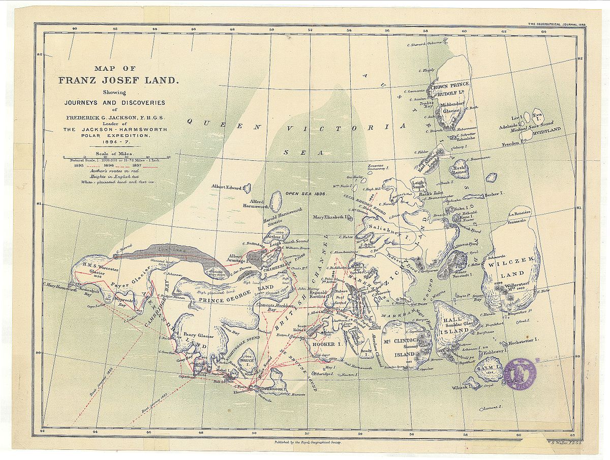
Queen Victoria Sea
The Queen Victoria Sea (Russian: ???????? ???????????????? ????????????????, Morye Korolevy Viktorii) is a body of water in the Arctic Ocean, stretching from northeast of Svalbard to northwest Franz Josef Land. It is obstructed by ice most of the year. This sea is named after Queen Victoria. Russian Arctic explorer Valentin Akkuratov claimed that a branch of the Gulf Stream reached as far north as the Queen Victoria Sea. Geography The Queen Victoria Sea is located at 81?? north latitude and 38?? east longitude. The Arctic Ocean farther north of the sea is frozen year round. The sea stretches as far west as the Sju??yane in Svalbard and as far east as Rudolf Island in the Franz Josef Archipelago. The islands of Kvit??ya and Victoria Island are located at the southern limit of this Arctic sea. To the south lies the Barents Sea. See also List of seas...
e: 2000000000000057507
Strings (13)
-
str_k__gdb_image
str.gdb:imagehttps://upload.wikimedia.org/wikipedia/commons/thumb/c/c0/Map_of_Franz_Josef_Land_showing_journeys_and_discoveries_of_Frederick_G._Jackson%2C_F.R.G.S._-_UvA-BC_OTM_HB-KZL_61_18_38.jpg/1200px-Map_of_Franz_Josef_Land_showing_journeys_and_discoveries_of_Frederick_G._Jackson%2C_F.R.G.S._-_UvA-BC_OTM_HB-KZL_61_18_38.jpg -
str_html_meta_format_detection
str.html:meta.format-detectiontelephone=no -
str_html_meta_generator
str.html:meta.generatorMediaWiki 1.44.0-wmf.8 -
str_html_meta_og_image
str.html:meta.og:imagehttps://upload.wikimedia.org/wikipedia/commons/thumb/c/c0/Map_of_Franz_Josef_Land_showing_journeys_and_discoveries_of_Frederick_G._Jackson%2C_F.R.G.S._-_UvA-BC_OTM_HB-KZL_61_18_38.jpg/1200px-Map_of_Franz_Josef_Land_showing_journeys_and_discoveries_of_Frederick_G._Jackson%2C_F.R.G.S._-_UvA-BC_OTM_HB-KZL_61_18_38.jpg -
str_html_meta_og_image_height
str.html:meta.og:image:height904 -
str_html_meta_og_image_width
str.html:meta.og:image:width1200 -
str_html_meta_og_title
str.html:meta.og:titleQueen Victoria Sea - Wikipedia -
str_html_meta_og_type
str.html:meta.og:typewebsite -
str_html_meta_referrer
str.html:meta.referrerorigin -
str_html_meta_robots
str.html:meta.robotsmax-image-preview:standard -
str_html_meta_viewport
str.html:meta.viewportwidth=1120 -
str_k__rdfs_comment
str.rdfs:commentThe Queen Victoria Sea (Russian: ???????? ???????????????? ????????????????, Morye Korolevy Viktorii) is a body of water in the Arctic Ocean, stretching from northeast of Svalbard to northwest Franz Josef Land. It is obstructed by ice most of the year. This sea is named after Queen Victoria. Russian Arctic explorer Valentin Akkuratov claimed that a branch of the Gulf Stream reached as far north as the Queen Victoria Sea. Geography The Queen Victoria Sea is located at 81?? north latitude and 38?? east longitude. The Arctic Ocean farther north of the sea is frozen year round. The sea stretches as far west as the Sju??yane in Svalbard and as far east as Rudolf Island in the Franz Josef Archipelago. The islands of Kvit??ya and Victoria Island are located at the southern limit of this Arctic sea. To the south lies the Barents Sea. See also List of seas... -
str_k__rdfs_label
str.rdfs:labelQueen Victoria Sea