- News
- Sport
- Politics
- Sci/Tech
- Showbiz
- Health
- Business
- Art
- Fashion
- Education
- Weather
- Automotive
- Aviation
- Religious
- Crime
1 image
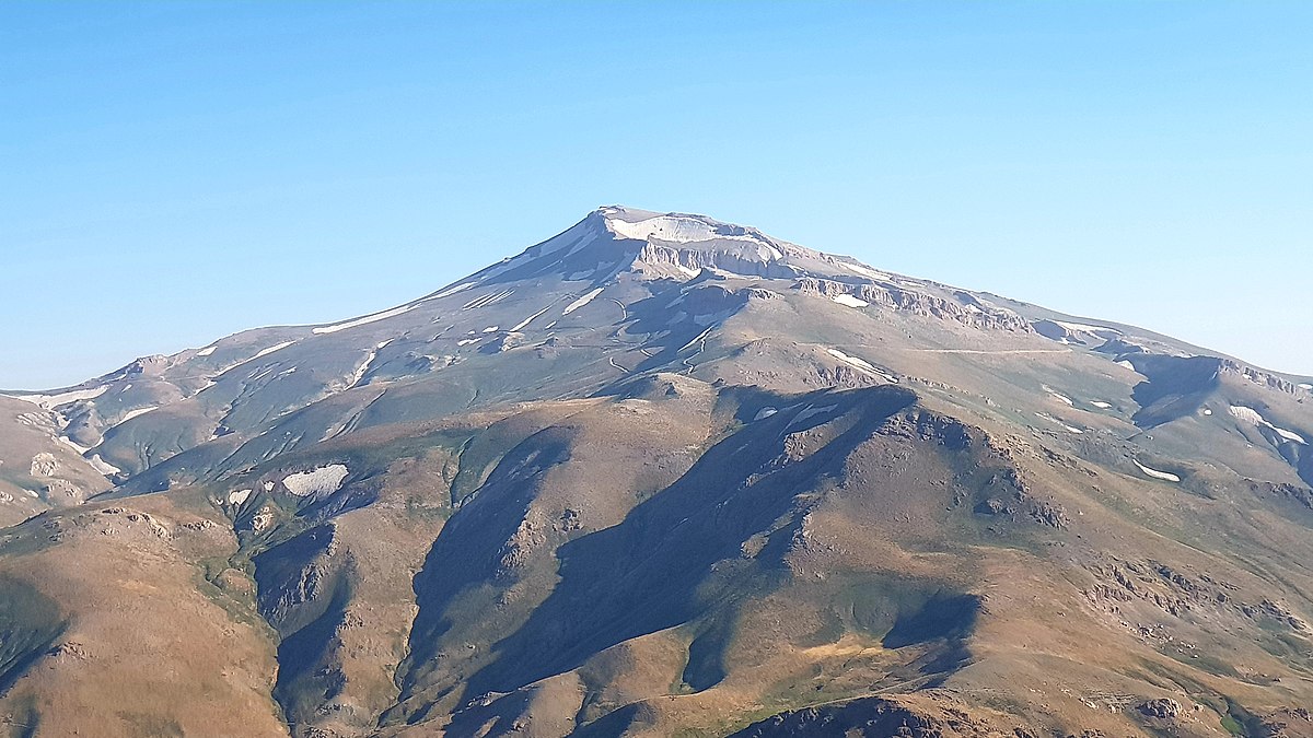
Cheekha Dar
Cheekha Dar (Kurdish: ????x?? Der??, Sorani Kurdish: ???????? ????????), which means Black Tent, is the local Kurdish name for the mountain, located in Kurdistan Region of Iraq, currently thought to be the highest in Iraq. It is claimed to be 3,611 m (11,847 ft) high in the CIA World Factbook. It is 6 km (3.7 mi) north of the village of Gundah Zhur and is on the border with Iran. It was climbed in November 2004 by English explorer Ginge Fullen, who recorded a GPS reading of 3,628 meters at the coordinates in the adjacent table. The location is consistent with SRTM and Russian topographic mapping, although these sources are more consistent with the CIA height. The first reported winter ascent was by Jonathan Beswick and Matthew DuPuy on March 18, 2011. The expedition GPS confirmed 3,611 m (11,847 ft). There is a danger of land mines in the area on approach between Hamilton Road and the village of Gundah Zhur. Some fields...
e: 2000000000000034295
Strings (13)
-
str_k__gdb_image
str.gdb:imagehttps://upload.wikimedia.org/wikipedia/commons/thumb/b/bd/Cheekhedar.jpg/1200px-Cheekhedar.jpg -
str_html_meta_format_detection
str.html:meta.format-detectiontelephone=no -
str_html_meta_generator
str.html:meta.generatorMediaWiki 1.44.0-wmf.8 -
str_html_meta_og_image
str.html:meta.og:imagehttps://upload.wikimedia.org/wikipedia/commons/thumb/b/bd/Cheekhedar.jpg/1200px-Cheekhedar.jpg -
str_html_meta_og_image_height
str.html:meta.og:image:height675 -
str_html_meta_og_image_width
str.html:meta.og:image:width1200 -
str_html_meta_og_title
str.html:meta.og:titleCheekha Dar - Wikipedia -
str_html_meta_og_type
str.html:meta.og:typewebsite -
str_html_meta_referrer
str.html:meta.referrerorigin -
str_html_meta_robots
str.html:meta.robotsmax-image-preview:standard -
str_html_meta_viewport
str.html:meta.viewportwidth=1120 -
str_k__rdfs_comment
str.rdfs:commentCheekha Dar (Kurdish: ????x?? Der??, Sorani Kurdish: ???????? ????????), which means Black Tent, is the local Kurdish name for the mountain, located in Kurdistan Region of Iraq, currently thought to be the highest in Iraq. It is claimed to be 3,611 m (11,847 ft) high in the CIA World Factbook. It is 6 km (3.7 mi) north of the village of Gundah Zhur and is on the border with Iran. It was climbed in November 2004 by English explorer Ginge Fullen, who recorded a GPS reading of 3,628 meters at the coordinates in the adjacent table. The location is consistent with SRTM and Russian topographic mapping, although these sources are more consistent with the CIA height. The first reported winter ascent was by Jonathan Beswick and Matthew DuPuy on March 18, 2011. The expedition GPS confirmed 3,611 m (11,847 ft). There is a danger of land mines in the area on approach between Hamilton Road and the village of Gundah Zhur. Some fields... -
str_k__rdfs_label
str.rdfs:labelCheekha Dar