- News
- Sport
- Politics
- Sci/Tech
- Showbiz
- Health
- Business
- Art
- Fashion
- Education
- Weather
- Automotive
- Aviation
- Religious
- Crime


Strings (14)
-
str_k__gdb_enwiki
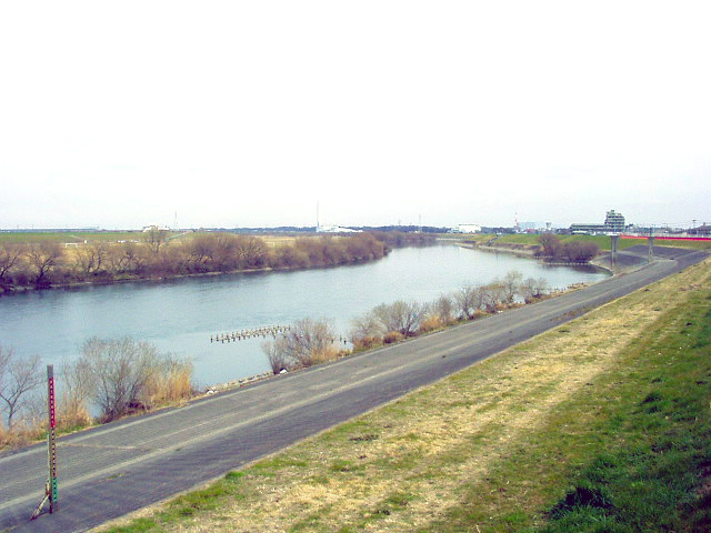
str.gdb:enwikiEdo_River -
str_k__rdfs_comment
str.rdfs:commentriver in Japan -
str_k__wkd_GeoNames_ID
str.wkdp:P15661864243 -
str_k__wkd_image
str.wkdp:P18EdoGawa2004.jpg -
str_k__wkd_OpenStreetMap_Relation_identifier
str.wkdp:P40218722355 -
str_k__wkp_description
str.wkp:descriptionRiver in the Kanto Plain, Japan -
str_k__wkp_displaytitle
str.wkp:displaytitle<span lang="en" dir="ltr"><span class="mw-page-title-main">Edo River</span></span> -
str_k__wkp_extract
str.wkp:extractThe Edo River is a river in the Kant?? region of Japan. It splits from the Tone River at the northernmost tip of Noda City in the Sekiyado district, crosses through Nagareyama and Matsudo, and empties into Tokyo Bay at Ichikawa, Chiba Prefecture. The Edo forms the borders between Tokyo, Chiba, and Saitama prefectures. The Edo River is 59.5 kilometres (37.0??mi) long. -
str_k__wkp_lang
str.wkp:langen -
str_k__wkp_originalimage_source
str.wkp:originalimage.sourcehttps://upload.wikimedia.org/wikipedia/commons/5/56/EdoGawa2004.jpg -
str_k__wkp_revision
str.wkp:revision1353372704 -
str_k__wkp_thumbnail_source
str.wkp:thumbnail.sourcehttps://upload.wikimedia.org/wikipedia/commons/thumb/5/56/EdoGawa2004.jpg/330px-EdoGawa2004.jpg -
str_k__wkp_title
str.wkp:titleEdo River -
str_k__wkp_type
str.wkp:typestandard
Numbers (7)
-
num_k__wkp_coordinates_lat
num.wkp:coordinates.lat35.670687 -
num_k__wkp_coordinates_lon
num.wkp:coordinates.lon139.950556 -
num_k__wkp_originalimage_height
num.wkp:originalimage.height480.0 -
num_k__wkp_originalimage_width
num.wkp:originalimage.width640.0 -
num_k__wkp_pageid
num.wkp:pageid13459759.0 -
num_k__wkp_thumbnail_height
num.wkp:thumbnail.height248.0 -
num_k__wkp_thumbnail_width
num.wkp:thumbnail.width330.0
Datetimes (1)
-
dnt_k__wkp_timestamp
dnt.wkp:timestampMay 9, 2026, 10:17 p.m.